Day 4 of the RPG Campaign Tour Challenge asks “is there a map?” Oh folks, there are so, so many maps of Greyhawk: the city, the region, the world, heck, even the celestial sphere known as Greyspace! For for our purpose’s, let’s focus on mapping the Plain of Greyhawk, which is where Greyhawk ’76 takes place.
Is there a Map? Give us a visual! Show us a map of your setting! Don’t have one? WHY NOT?!?
Visit Nuketown’s RPG Campaign Tour Challenge 2026 Prompts page for the rest of our challenge posts.
Sourcing the Map
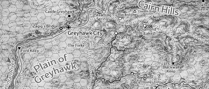
The 2024 edition of the Dungeon Master’s Guide (Amazon) comes with a number of full-color maps for the World of Greyhawk, including a regional map of the Flanaess (the main setting for the campaign world), a local map of the Plain of Greyhawk, and an isometric map of the Free City itself.
As a diehard Greyhawker, I’ve got a ton of other maps as well, and at the campaign’s start, I was looking forward to breaking out my City of Greyhawk boxed set maps for the city proper.
Alas, as noted earlier, we never made it to the city. Instead, all the action is taking place on the Plain of Greyhawk, the Cairn Hills, and the Mistmarsh.
Have Map, Will Customize
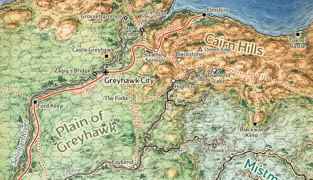
To support the campaign’s more regional focus, I snagged a copy of the Plain of Greyhawk map from D&D Beyond. I then imported it into Inkarnate and began tweaking.
I’ve got a GM-only view, which includes the various secret hideouts of the Burrow Boys, lairs of monsters, and other threats, as well as a player-centric view. I exported the latter to Roll20 to use as an in-game reference.
Roll20’s configured to the correct miles-per-hex scale, which helps when the players ask, “So how far is it to Blackwall Keep?”
My version of the map is a cartography mishmash, pulling in towns, villages, and landmarks that have appeared in various Greyhawk source books, magazine articles, and WotC web posts over the years (as well as a few looted from Oerth Journal, the Greyhawk fanzine).
Featured Image Meta
An overland map of the Plain of Greyhawk, augmented by Inkarnate. Credit: Wizards of the Coast.